
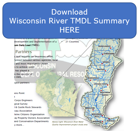
The U.S. EPA approved the Wisconsin River TMDL on April 26, 2019.
The DNR, together with many partners throughout the basin, are working to improve water quality of the Wisconsin River, its reservoirs and tributaries. The Total Maximum Daily Load (TMDL) study provides a strategic framework and prioritize resources for water quality improvement in the Wisconsin River Basin. The Wisconsin River TMDL study area spans Wisconsin’s central corridor from the headwaters in Vilas County to Lake Wisconsin in Columbia County, covering 9,156 square miles (approximately 15 percent of the state). DNR’s Wisconsin River TMDL website.
.
.
Historical Presentations to the Stormwater Coalition:
WI River TMDL July 2015 Update Presentation